Showing posts with label Volcano. Show all posts

Will Smith in Papua New Guinea: Welcome to Earth

Will Smith's National Geographic docu-series, Welcome to Earth, celebrates our planet's natural wonders. The series takes viewers on epic journeys to some of the most remote and awe-inspiring places on Earth, where Smith explores the planet's unique ecosystems and learns about the forces that drive it.


Will Smith in PNG and Vanuatu

In 2021, Smith visited Mount Yasur volcano on Tanna in Vanuatu. The volcano is one of the most active in the world, and its eruptions are so regular that it's known as the "world's most accessible active volcano." Visitors can come right up to the edge of the crater and witness the lava flowing and the ash spewing into the sky.

Smith is currently filming the final episode of Welcome to Earth in Papua New Guinea. PNG is one of the most biodiverse countries in the world, and he is expected to film a variety of things, including wildlife, people, and the environment.

will smith in Papua New Guinea


Significance of the Welcome to Earth Documentary Series

The Welcome to Earth documentary series is important for several reasons. First, it showcases the beauty and diversity of our planet. Second, it educates viewers about the importance of protecting the environment. Third, it inspires people to explore the world and learn about different cultures.

For Vanuatu (2021) and Papua New Guinea (2023), the Welcome to Earth documentary series is a unique opportunity to showcase their natural beauty and cultural heritage to a global audience. 

The documentary is also likely to boost tourism to both countries, which will benefit the local economy.


Specific Places and Filming Topics in Papua New Guinea

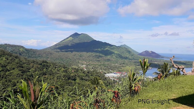
In Rabaul: Will Smith may film the Rabaul Active Volcano Mt Tavurvur erupting or interview scientists studying its unique ecosystem. The Rabaul Caldera is a majestic group of 13 volcanoes with an opening out into the Simpson Harbour. Smith and his crew could film the pristine waters of the harbour and all the life-forms underwater, film the caldera from above or explore the rainforest.

In New Ireland Province: Smith may visit the Tabar Islands, a group of volcanic islands known for their pristine beaches and coral reefs. He may also visit the Tens Islands, a remote atoll known for its dugong and sea turtle populations.

Whatever Will Smith chooses to do, there is more to see and be amazed by in Papua New Guinea.


Other Unique Things to Film in New Ireland

Limestone Caves: New Ireland Province is also home to a number of limestone caves. These caves are often decorated with stalagmites and stalactites and house a variety of bats and other animals.

Shark Hunters: The Tabar Islands are known for their traditional shark hunting. These hunters use traditional methods to fish for sharks and have a deep respect for the ocean and its creatures. He can learn a thing-or-two from them.

Conclusion

We eagerly anticipate Will Smith's discoveries in the final episode of Welcome to Earth. We are confident that the episode will celebrate Papua New Guinea's natural wonders and remind us of the importance of protecting our forests and oceans.


💧What are some of the natural wonders of Papua New Guinea that the outside world know nothing about? Share your thoughts in the comments below!

Papua New Guinea's Rabaul Volcano Eruption: Mt Tavurvur

The dawn of August 29, 2014, started like any other day in the town of Rabaul, nestled against the picturesque backdrop of Mount Tavurvur in Papua New Guinea. However, this tranquil morning was destined to be etched in history as one of the most significant events for the resilient people of this volcanic region.

Mt Tavurvur Volcano Eruption - Papua New Guinea
IMAGE: Start of the Climb to the Top | Mt Tavurvur


Papua New Guinea's Rabaul Volcano Eruption: Mt Tavurvur

Mount Tavurvur, a formidable stratovolcano, had been both a source of wonder and concern for the residents of Rabaul. Its majestic slopes and lush vegetation held secrets of its tumultuous past – a past punctuated by eruptions that had shaped the landscape and the community. 

In 1994, its fiery fury had wreaked havoc upon Rabaul, leaving scars that the town had courageously borne. But little did anyone know that another eruption was lurking beneath its serene exterior, preparing to awaken.

As the morning sun painted the skies with shades of gold, the earth began to tremble, sending ripples of unease through the town. Locals who had witnessed the first devastating eruption of 1937, were on edge, wary of the signs nature was displaying. 

"We've been through this before," Maria whispered to Samuel, clutching his arm as they watched the distant plume of ash rising from the heart of the mountain.


Local leaders in forefront at a time of need

News spread quickly through the town, and leaders like Mayor Simon and volcanologist Dr. Rodriguez swung into action. Roads leading to safer areas were marked, and evacuation plans were set in motion. 

The memory of the 1937 eruption was fresh in their minds, a reminder of the importance of preparedness. 

"We can't afford to wait. We need to act swiftly to ensure the safety of our people," Mayor Simon declared.

The rumbling of the earth escalated, and by 6:00 AM, the mountain roared to life. The sky turned dark as ash and smoke billowed into the atmosphere, blocking out the sun's rays. The ground shook violently, and the town was thrown into chaos. People scrambled to gather their belongings and make their way to the designated evacuation centers.

With remarkable unity, the residents of Rabaul, led by local leaders and officials, embarked on a journey of survival. The spirit of community shone brightly as families opened their homes to those who had lost everything. 

The churches, particularly the Catholic Church under the guidance of Archbishop Carl Henn, became beacons of hope, providing shelter, food, and comfort to the displaced.


Rabaul Volcanological Observatory Volcanologist

Volcanologist Dr. Rodriguez, despite being hindered by the thick blanket of ash, managed to communicate vital information about the eruption's progression. 

"This eruption is comparable in scale to the 1994 event," he explained. "We're closely monitoring lava flow and seismic activity to ensure the safety of everyone."

The eruption had caught even the national government off guard, prompting Prime Minister Rabbie Namaliu (who was also the member for Kokopo) to visit Rabaul, accompanied by other officials, to assess the situation firsthand. Upon returning to Port Moresby, Prime Minister Namaliu declared a state of emergency, ensuring that resources were swiftly directed towards relief efforts.

Mt Tavurvur Volcano Eruption - Rabaul Volcanological Observatory Volcanologist Volcanologist Dr. Rodriguez, despite being hindered by the thick blanket of ash, managed to communicate vital information about the eruption's progression.
IMAGE: View from the Rabaul Volcanological Observatory


Australia and the international community help

Australia and the international community, deeply moved by the catastrophe, extended their support. Aid and supplies arrived at Tokua Airport, a lifeline for the affected communities. The disaster, while testing the limits of preparation and response, showcased the resilience and unity of the Papua New Guinean people.

Days turned into weeks, and as the ash settled, the true extent of the damage became evident. Though the eruption had caused widespread destruction, the loss of life remained remarkably low, a testament to the swift action and preparedness of the people.

As the healing process began, the people of Rabaul looked to the future with determination. The lessons learned from this eruption would serve as a blueprint for facing the uncertain future that the volatile region held. 

Mount Tavurvur, a mountain of both beauty and danger, had once again reminded its residents of their strength and resilience in the face of adversity.


Story of Rabaul's volcanic eruption

The story of Rabaul's volcanic eruption serves as a poignant reminder that nature's fury can strike at any moment. 

Preparedness, unity, and a shared sense of responsibility can make all the difference in overcoming the challenges presented by such events. 

As Papua New Guinea continues to forge its path forward, the courage and determination displayed by the people of Rabaul stand as a source of inspiration for generations to come.


PNG Insight compiles this story of Rabaul's volcanic eruptions from online sources to draw attention to the dangers of volcano eruptions in Papua New Guinea, especially in the New Guinea Island Region and Manam Island in the Momase Region.

Volcanic Eruption in PNG: Mt Ulawun West New Britain Province

Nestled near Bialla Town, West New Britain Province in Papua New Guinea, lies a force of nature that has both fascinated and struck fear into the hearts of scientists and locals alike—the mighty Mount Ulawun. It is known to be the highest and steepest of the 6 active volcanoes in PNG in 2023.

This active volcano, known for its explosive eruptions and hazardous nature, unleashed its fury force in 2019, spewing ash into the sky. On June 3, 2022, at 8:20 AM, Mt. Ulawun erupted briefly, urging heightened alertness. 

It erupted recently on the 25th of September 2023 with a level 1 Alert issued by the Rabaul Volcano Observatory Centre. Here are some facts and the latest updates about Mt Ulawun Eruptions.


2023 Eruptions and Alerts: Mount Ulawun Erupts Again, Plumes of Ash Reach 15,000 Metre

Mount erupted again last night, 20th of November, 2023. The eruption was significantly larger than the previous eruption in September, with plumes of ash reaching altitudes of up to 15,000 meters (49,213 feet).

The eruption triggered a Stage 3 alert from the Geohazards Management Division (GDM) of Papua New Guinea. This is the highest alert level, indicating a significant risk of volcanic activity and potential hazards.

GDM has advised residents of surrounding areas to evacuate to safer locations and to monitor the situation closely. The division has also urged airlines to avoid flying near the volcano.

Ashfall from the eruption is expected to reach areas downwind of the volcano, including the town of Rabaul and the surrounding islands.

The eruption has also caused disruptions to air and sea travel.

Authorities are urging people in the region to exercise caution and to follow the instructions provided by GDM.


Mount Ulawun - One of the ''Decade Volcanoes." 

Mount Ulawun stands out as one of the world's most hazardous volcanoes, earning its place on a list of "decade volcanoes." 

These volcanoes, including Ulawun, are singled out for their potential to cause widespread devastation with large and violent eruptions. These explosive events often lead to the release of thick grey ash clouds, reaching heights of thousands of metres, as witnessed in its recent eruption. 

The volcanic activity has been monitored by the country's Geohazards Management Division based in Rabaul and other Geohazards Management Centres in the Pacific, which plays a crucial role in keeping communities safe.

Mt Ulawun Eruption 2023 - volcanic eruption in png
PNG Insight Photo

Papua New Guinea Volcano Eruption: Mt Ulawun Fury 

The history of Mount Ulawun's eruptions is riddled with tales of destruction and resilience. In 2019, the volcano experienced a rapid succession of eruptions, causing thousands to flee their homes in fear. 

The ash plumes soared high into the sky, even disrupting airline pilots' routes in the vicinity. 

The eruption's impact was far-reaching, with ash fall observed in various places downwind from the volcano, illustrating the extent of its influence on the region.

Read about the latest PNG Volcano eruption on Bougainville's Mt Bagana


Ulawun Eruption 2023

On Monday, 25th September 2023, at 4:30 PM, Mount Ulawun in Ulamona, West New Britain Province, Papua New Guinea. At present the eruption is categorised as a level 1 eruption (on a four-level scale, according to the PNG Geohazards Management Division (Rabaul Volcanic Observatory Centre). This means that the eruption was minor and produced only a small amount of ash.

The eruption was accompanied by increased seismicity and volcanic tremors, but there were no reports of damage or injuries. The Geohazards Management Division is monitoring the volcano closely and will provide further updates as needed.

Mount Ulawun is an active stratovolcano that last erupted on August 3, 2019. It is located on the northern coast of New Britain Island and is one of the most active volcanoes in Papua New Guinea.

Mount Bagana, another active volcano in Papua New Guinea, is currently at a level of 2 alert, meaning there is a moderate risk of an eruption. The Geohazards Management Division is also monitoring Mount Bagana closely.


The Enigmatic Caldera Threat

One of the most intriguing aspects of Mount Ulawun is its looming threat of a catastrophic summit collapse, akin to the infamous 1980 eruption of Mount St. Helens. This possibility has earned the volcano its designation as a "decade volcano." 

Scientists have noted that nearby large calderas tend to form when a volcano reaches around 1900 metres in height. With Ulawun towering at 2334 metres, the risk of a massive collapse or caldera-forming eruption is a cause for concern, potentially putting thousands of lives at stake.


The Fiery Forge of Ulawun

The volcanic history of Mount Ulawun is etched in its features. The scar on its southern flank is a reminder of an ancient summit collapse that occurred thousands of years ago, causing a significant portion of the volcano to slide northward. 

Lava flows, often originating from satellite cinder cones, have shaped its landscape and pose an ongoing threat. 

The volcano's eruptive power was evident in the colossal ash plumes of 2019, reaching remarkable heights and impacting the surrounding environment.

PNG Volcano Eruption - Mt Ulawum
IMAGE: Twitter/AFP - 2019 Eruption


The Peril to Aviation

Mount Ulawun's eruptions transcend local impacts, reaching the skies and causing trouble for aviation. 

Its explosive nature has made navigating the area a challenge for aircraft, with the threat of ash damaging engines. 

The 2019 eruption, with its towering ash plume, serves as a vivid reminder of the volcano's potential to disrupt air travel, posing yet another layer of concern in managing its effects.


Resilience and Preparedness

In the face of Ulawun's relentless eruptions, local communities have showcased remarkable resilience. Evacuations and preparedness measures have become integral to the region's response strategy. 

Authorities, both local and international Geohazards Management Centres, work tirelessly to monitor the volcano's activity and provide timely alerts to those in its shadow. 

Learning from past experiences, the people of Papua New Guinea continue to adapt to the challenges posed by their fiery neighbour.


Uncertain Future, Everlasting Vigilance

As we contemplate the enigmatic nature of Mount Ulawun, one thing remains certain—it is a force to be reckoned with. 

Its explosive potential, history of eruptions, and looming threat of a massive collapse keep scientists and communities on high alert. 

While the future may hold uncertainty, the lessons learned from this volcanic giant serve as a reminder of the delicate balance between human habitation and the power of the natural world.


Conclusion (Papua New Guinea Volcano: Mt Ulawun)

The saga of Mount Ulawun unfolds as a tale of both awe and apprehension. Its towering presence, explosive eruptions, and potential for devastation weave a narrative that speaks to the intricate relationship between humanity and the forces of nature. 

As we marvel at the power of this volcanic giant, we are reminded of the need for vigilance, preparedness, and the unwavering human spirit in the face of the unknown.

Papua New Guinea Volcano: Mt Bagana Eruption (Bougainville)

In a catastrophic turn of events recently, Papua New Guinea's autonomous region of Bougainville has been thrust into turmoil as Mount Bagana, a formidable anti-city volcano, erupted with explosive force. 

The eruption, characterised by towering ash plumes and pyroclastic flows, thought to have affected thousands of lives, reshaping the landscape and leaving a trail of destruction in its wake.

Mt Bagana Eruption 2023


Unforeseen Displacement and Environmental Catastrophe

As reported by the ABC News Australia, the impact of the eruption has been staggering, with over 8,000 residents from around ten villages at the base of Mount Bagana being displaced from their homes. 

The grim reality is that this number has nearly doubled from initial estimates, reflecting the unprecedented scale of the disaster. 

As the eruption continued, pyroclastic flows - searing-hot mixtures of ash, gas, and volcanic rock - surged down the slopes of the volcano, devouring everything in their path. 

One of the most pressing concerns arising from this catastrophe is the contamination of water sources and the destruction of crops. The livelihoods of the local population, deeply intertwined with the land, have been shattered. 

The once-thriving agricultural areas have been transformed into desolate landscapes, with ash-covered fields serving as grim reminders of the forces of nature at play.


Read about the latest events on Mt Ulawun's Activities, click here


Anatomy of Bagana Volcano: Unraveling the Explosive Fury

Bagana Volcano, a towering sentinel on Bougainville Island, is a striking example of an anti-city volcano, characterised by its dome-capped cone structure. 

The cone, made primarily of andesite - a silica-rich volcanic rock - plays a critical role in modulating the volcano's activity. Unlike more fluid lava seen in some eruptions, Bagana's lava is crumbly and viscous, akin to a polymer, which hampers its flow.

The distinctive pinkish-white colour of the dome hints at its felsic composition, rich in silica. This composition makes the lava exceptionally sticky, impeding its movement and often leading to a build-up of pressure beneath the dome. Eventually, this pressure reaches a breaking point, triggering explosive eruptions that propel ash and volcanic debris high into the atmosphere.

The eruption's fury is further manifested in the lava's behavior. Channels, akin to streets, form down the slopes of the volcano as the molten rock makes its descent. 

The flow, while destructive, is eerily reminiscent of similar patterns observed in other volcanic regions, such as Indonesia and Iran.


Tectonic Dance of Fire: A Geological Context

Bagana's explosive temperament finds its roots in the tumultuous geological dynamics of the Pacific Ring of Fire. The region, an arc of seismic and volcanic activity encircling the Pacific Ocean, is notorious for its frequent eruptions and earthquakes. 

Bougainville Island's placement atop a subduction zone - where the Indo-Australian Plate descends beneath the Pacific Plate - provides a volatile setting for volcanic activity.

The underwater subduction process fuels the creation of volcanic islands, contributing to the unique topography of the region. Bagana's location, perched on the edge of this volatile tectonic ballet, renders it vulnerable to sudden and dramatic eruptions.


Bagana's Papua New Guinea Volcano Eruption

As Bougainville grapples with the aftermath of Bagana's explosive eruption, the focus shifts towards recovery and resilience. Efforts to provide aid, restore water sources, and support affected communities will be crucial in rebuilding shattered lives. 

The disaster serves as a somber reminder of the unpredictable power of nature, prompting calls for enhanced monitoring systems to detect early signs of volcanic activity.

The eruption of Bagana Volcano stands as a testament to the delicate equilibrium between the Earth's inner forces and the lives of those dwelling on its surface. It serves as a poignant reminder of the need for preparedness, community support, and scientific advancement to navigate the intricate dance of geology and human existence. 

As Bougainvillians a resilient people ans will rebuild their lives with the unwavering spirit of a community determined to rise from the ashes of catastrophic eruption.

Earthquake in PNG Just Now - How to Get Latest Updates

Papua New Guinea is located in the Pacific Ring of Fire, an area known for its frequent seismic activity. Earthquakes can occur anytime in this region, and staying informed about the latest earthquake updates is crucial. Here are five ways to get the latest updates on earthquakes in the Pacific and Papua New Guinea.

Qarthquake in PNG Just Now


USGS Earthquake Hazards Program

The USGS (United States Geological Survey) Earthquake Hazards Program is a reliable source of earthquake information. It provides real-time updates on earthquakes around the world, including Papua New Guinea. 

Their website offers a detailed map of earthquakes that have occurred in the past hour, day, week, or month, along with information on their magnitude, depth, and location.


Earthquake Alert! App

The Earthquake Alert! App is an excellent way to stay updated on the latest earthquakes. 

This app provides real-time earthquake information, including the location, magnitude, and depth of each earthquake. 

It also offers push notifications for earthquakes over a certain magnitude.


Papua New Guinea Geophysical Observatory

The Papua New Guinea Geophysical Observatory (PNGGO) is the national agency responsible for monitoring seismic activity in Papua New Guinea. 

They provide real-time earthquake information and can be a valuable source of information during and after an earthquake.


Twitter

Twitter is an excellent platform for getting real-time updates on earthquakes. 

Many news organizations, including the USGS, post updates on Twitter as soon as an earthquake occurs. 

Following these accounts can provide quick updates on earthquakes.


Local News Outlets

Local news outlets in Papua New Guinea often cover seismic activity in the region. Tuning into local news broadcasts, reading local newspapers, and following local news outlets online can provide reliable information about earthquakes in the region.


Earthquake in PNG Just Now

While these five methods are great for getting the latest updates on earthquakes, many people may not realize that not all information found online is reliable. It is important to verify any information found online with multiple sources. 

Additionally, not all sources are equally reliable. It is essential to prioritize official sources, such as the USGS and PNGGO, over non-official sources such as social media accounts or personal blogs. It is also essential to know the difference between magnitude and intensity when reading earthquake information. 

earthquake in PNG today latest updates


Earthquake magnitude and intensity

Magnitude refers to the amount of energy released by an earthquake, while intensity refers to the level of shaking at a specific location. 

The two are not the same, and it is important to understand the difference when reading earthquake information.


Earthquake in PNG Latest Updates

Finally, staying informed about earthquakes in the Pacific and Papua New Guinea is crucial for safety and preparedness. 

Utilizing multiple reliable sources such as the USGS, Earthquake Alert! App, PNGGO, Twitter, and local news outlets can provide valuable real-time information. 

Verifying the information and prioritising official sources are key to obtaining reliable and accurate earthquake updates.

POST A COMMENT.

SEARCH THE ENTIRE SITE HERE

Latest on Vote of No Confidence in Papua New Guinea 2024

Latest on Vote of No Confidence in Papua New Guinea 2024
CLICK ON THE IMAGE TO FIND OUT